This trail is commonly referred to as the Greyton — McGregor Trail. I have run it as it is the route of the Bushman’s Blitz Trail Run (starting and finishing on the Greyton side) and since hiked it in the standard 2-day format (starting and finishing on the McGregor side).
Getting there: take the N1 from Cape Town turning at Worcester to Robertson, and then down to McGregor. Drive through McGregor, continuing out the other side of town where the road becomes a dirt road, passing between 2 dams. Continue up the pass until you reach the signs for Boesmanskloof.
GPS Coordinates: -34.010194, 19.715614
As far as I know, most people choose to start and finish in Greyton; this may simply be because it is commonly referred to as the “Greyton — McGregor Trail”. You can start at either end. The Greyton end of the trail is within walking distance on the outskirts of the small hamlet, while the McGregor side is actually some 15 km from the trailhead. There are several accommodation options on the McGregor side of the trail: http://www.boesmanskloofmcgregor.com If you are battling with accommodation at the McGregor end, consider doing it in the opposite direction, and staying somewhere like Zebra Moon in Greyton. Overnighting in Greyton not only affords you many more accommodation options but also offers you options for meals and even shopping for supplies which reduces what you must carry on your back.
You could do it one way as a one-day hike but be warned that the round trip between the two towns by road is about 150km. Ironically, the hike follows a route on which a pass was to be built to join the two towns, the project failed due to the embezzlement of funds leaving us with a magnificent trail to hike!
Day 1
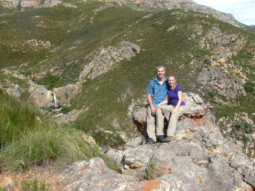
After parking our car near the stone houses, we grabbed our gear and headed to the trailhead. From the sign, you can see the gorgeous Eagle’s Nest stone house (one of the overnight accommodation options had you chosen to hike from the Greyton end). Start walking down the jeep track and almost immediately you will find a set of signs offering you the option of heading left down into the valley or continuing down the jeep track with Eagle’s Nest on your left. We chose to head down the trail on the left which takes you steeply down the valley to the Gobos River.
For much of the trail, you will be walking next to this river, and the highlight of the trail must certainly be Oakes Falls where you will be able to enjoy a dip in the deep pool below the waterfall.
At the end of the valley, you will climb up to the saddle above which is announced by a tall trail sign. This is where work on the proposed mountain pass between Greyton and McGregor ended on the Greyton side so you are on fairly good jeep track again which you can see heading down the mountain to Greyton which you can see waiting below you.
Cross the Gobos River by boulder-hopping if you have waterproof boots, else take your footwear off and enjoy the cool water. You will see the jeep-track on the opposite bank a little downstream (to the left). Continue along the track until you reach the tar road, and from there head to your accommodation for the night.
After checking into Zebra Moon we strolled down to the supermarket to buy lunch and snacks for the following day. We returned to the backpacker for a shower and a quick snooze before walking back down to town again for dinner at Searles.
Day 2
Standing in Greyton, you can see the trail winding its way up the mountain: it is quite a monster hill! Once at the top of this climb, you are looking back up the valley towards McGregor, and the trail snakes down ahead of you into the valley.
We stopped for an early lunch and a swim at Oakes Falls again. At the signposted intersection we to the left up the steps and switchbacks to reach the jeep-track again. This is where work on the pass ended from the McGregor side. The jeep track continues to climb until you pass Eagle’s Nest and reach the end of the trail.